
The Ridgeline Trail System is one of Eugene’s precious outdoor gems. While hiking, running, mountain biking, or walking your dog in this green paradise, you would never guess that you are only a few miles from downtown Eugene. The trail, originally starting at Spencer Butte, was established in 1940, thanks to a grass-roots campaign that collected $5 donations from citizens to impart a feeling of ownership over the butte.
Today, the Ridgeline Trail System has grown to a total of 12 miles of trail, with seven established trailheads.
There are four major sections of the Ridgeline Trail System, and each one has something different to offer, whether it be forests of dense Douglas fir, white oak savannas, meadows filled with wildflowers, or stunning views of the Cascade Mountains. Whether you are a long-time Eugene resident or a visitor to the area, the Ridgeline Trail System has something for everyone.
Section 1: Blanton Ridge to Willamette St.
This section is a short 1.8-mile (each way) trail that meanders from Blanton Ridge to Willamette Street. The trail starts off at a beautiful meadow where, in late spring and early summer, you will find many wildflowers blooming. The trail also offers oak trees, fruit trees, and views of Eugene, with the big yellow O at Autzen Stadium a prevalent view in the distance. With its park-like setting, this is a great section to do with younger children.
Section 2: Willamette St. to Spencer Butte summit
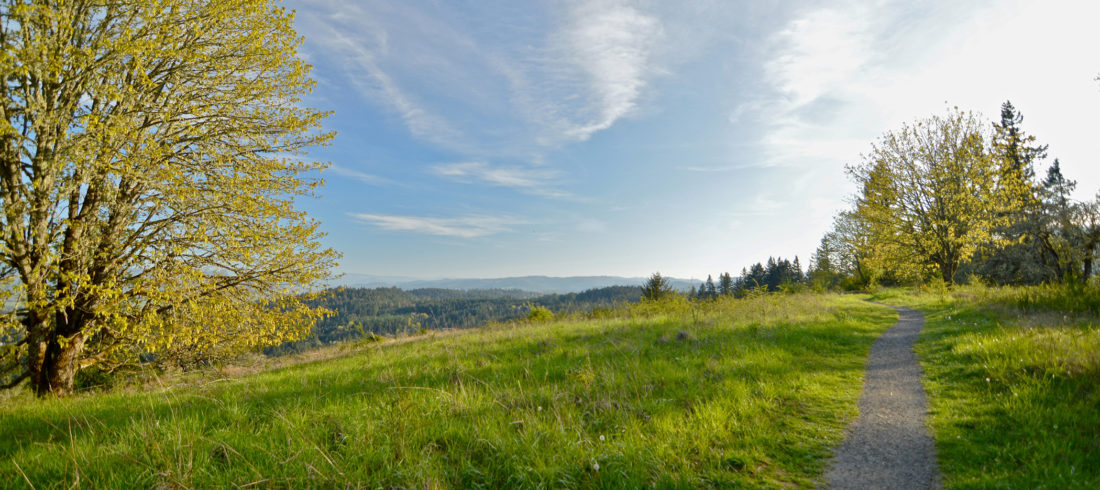
If you are looking for a longer hike, this section is highly recommended. This 5.4-mile loop showcases thick, mossy woods with dense, luscious fern undergrowth and even some small streams. As you climb up Spencer Butte, you get 360-degree views of the Willamette Valley. Spencer Butte rises 2,062 feet above sea level, and it can be done as a shorter hike of 2.2 miles starting at the Spencer Butte trailhead, which is just a little bit farther up Willamette Street than the lower trailhead. If you want to avoid the climb altogether, you can continue on the lower Ridgeline Trail to Fox Hollow Road and make it an easy 2-mile (each way) hike through the beautiful woods. This is definitely the most heavily used section of the Ridgeline Trail.
Section 3: Fox Hollow Rd. to Dillard Rd. West
Sections 3 and 4 are the only parts of the Ridgeline Trail that are mountain bike–friendly. These trails are great, especially for beginner mountain bikers, because they are so well maintained and are, for the most part, also fairly wide. Depending on where in town you are coming from, this 1.8-mile loop can be accessed from either Fox Hollow Road or Dillard Road. This loop gets a lot more sun than the previous two sections of the Ridgeline Trail, so here you will find more wildflowers such as trillium, wild lilies, wild iris, and even calypso orchids.
Section 4: Dillard Rd. East to Mt. Baldy
If you haven’t gotten your fill of hiking or mountain biking and you have a desire to connect sections 3 and 4, there is a brand new connector trail that was built in 2014. It takes you the 0.4 miles to the Dillard Road East trailhead; previously, you had to walk or bike on the main road. If you are coming from a different side of town, you can also access the trail going up to Mt. Baldy at the Spring Blvd. trailhead. The distance of 0.5 miles to the top is the same from either trailhead, although it is a bit steeper and a lot more shaded by trees if you are coming from Spring Blvd. If you are coming from the Dillard trailhead, you will get a great viewpoint to the west, where you can catch a stunning view of Spencer Butte towering over the neighborhoods below. At the top of Mt. Baldy, there is a beautiful open meadow and an impressive view of South Sister in the distance, and a memorial bench is perfectly situated for a glorious sunset view across Eugene.
More information on the Ridgeline Trail sections can be found at hikeoregon.net.
